The Road to Vacationland
Location: Wright Gallery
Throughout the 1800s, the accelerating Industrial Revolution brought textile mills and other factories to cities in New England. Many rural residents abandoned farming for the higher, more regular pay of factory work and the social connections and entertainment of the urban areas. However, the resulting concentration of smoke and people and the cacophony of machinery and city sounds led many to seek the relative quiet of the woods, lakes and mountains.
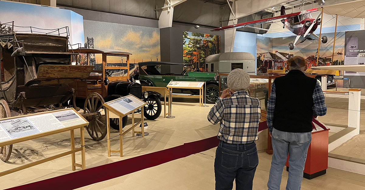
Maine’s proximity to major industrial areas, like Boston, made it an ideal escape for city dwellers, but for many years, the biggest obstacle for would-be vacationers was simply getting there. For more than 200 years, the evolution of roads and vehicles expanded the number and variety of people who could experience Maine’s landscape.
Stagecoaches, railroads and automobiles were just some of the many ways Americans have reached Vacationland. When Maine became a state in 1820, some 300,000 people lived within its 30,000 square miles. Its major industries, like farming, lumber and shipping, were more focused on sending products out than bringing tourists in. Many products and people moved by water using Maine’s long coastline and complex network of rivers. Moving on land and through the wilderness was limited to travel by foot or by horse. To create Vacationland first required the development of routes and roads that helped Mainers do business.
The first roads in Maine were rudimentary at best. They were marked with granite blocks or milestones, but virtually all were dirt affairs, and many became impassable, muddy bogs during the spring thaw. When travelers reached a river, there were no vehicle bridges to easily make a crossing. They either needed to ford the rivers or cross on a ferry.
Some of the state’s best roads were the five toll roads built when Maine was still a district of Massachusetts. Among these was the Camden Turnpike, “which bypassed an earlier road over Megunticook Mountain” and linked Lincolnville to Camden Harbor.
Traveling as a passenger along these roads was even more difficult when using the commercial stagecoach companies. In 1825, the stage line traveling between Bangor and Portland took 36 hours and cost passengers $7.50 (about $200 in 2019). Today, that same trip by bus takes less than three hours and costs about $25.
Among those who helped Maine develop was surveyor Isaac Abbott, who mapped a new stagecoach route from Augusta to Dixmont in 1832. While Maine was barely a decade old when this map was made, the route pioneered a corridor through the state that can still be seen in major highways, like Route 201, I-95 and Route 202. Abbott’s map fulfilled a need within the young state to create commercial routes to serve passengers, mail and freight.
25,000 Miles of Fine Smooth Roads
In the 1920s, the Maine tourist changed with the rise of the automobile, the middle class and paid vacations. The state was no longer exclusively a domain of the wealthy as improved roads meant drivers could reach almost any place in Maine with ease and at minimal expense. Big houses along the coast were adapted to host tourists with the addition of electricity and flush toilets. By the end of the decade, the Maine Publicity Bureau targeted “autotourists” with ads in The New York Times promoting Maine’s “25,000 Miles of Fine Smooth Roads.”
Tourism downturns, like the Great Depression and World War II, forced many Americans to visit Maine only in their imaginations through travel articles and books written about life on isolated islands, cabins deep in the woods and rocky coastal fishing villages. Yet tourism remains one of Maine’s biggest industries. By the late 1980s, 7 million tourists were coming every year and nearly 60,000 people worked for tourism businesses, including hotels, campgrounds and amusement parks. Even as the industry grew, the reputation of Maine remained as a place where visitors could escape the stressors of modern life for peace and picture-perfect moments by lakes, mountains or the ocean.
